Comparing Drone Maps and Ground Photos for Project Progress Reporting
Tracking progress on a construction site, a quarry, or a large land development project has always relied on visual evidence. For years, that evidence came from ground photos taken by a site manager walking the perimeter with a camera. Today, drone maps offer a different kind of record: a bird's-eye view stitched together into a single, measurable image. Both approaches have their place, but they serve different purposes and produce different kinds of information.
Understanding the strengths and limitations of each method helps project teams decide what to use and when. The choice is not always about replacing one with the other. Often, the best reporting strategy combines both, using each where it adds the most value.
What Ground Photos Do Well
Ground photos are familiar, cheap, and easy to take. Almost anyone on site can pull out a phone and capture a close-up view of a specific area. A ground photo shows texture, colour, and detail that a drone flying at 100 metres cannot capture. It can reveal cracks in a concrete pour, the condition of exposed rebar, or the finish on a weld. For documentation that requires fine detail, a ground photo is hard to beat.
Ground photos also work well for confined spaces. Inside a building, under a bridge, or in a narrow trench, a drone may not be able to fly safely. A person with a camera can get into those spots and record exactly what is happening.
The main limitation of ground photos is context. A single photo shows only what is in the frame. To understand how that spot relates to the rest of the site, you need many photos and a mental map. Over time, keeping track of where each photo was taken and what it shows becomes a management problem. Photos pile up in folders, and matching them to a specific date or area takes effort.
What Drone Maps Bring to Reporting
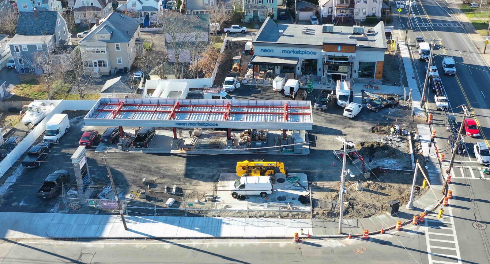
A drone map, sometimes called an orthomosaic, is a composite image made from many overlapping photos taken from a drone. Software processes those images to correct for lens distortion and perspective, producing a single, seamless, top-down view of the entire site. The result is a map that can be measured with accuracy close to that of a survey-grade instrument.
For progress reporting, drone maps offer several advantages:
- They show the whole site at once, so stakeholders can see how different areas relate to each other.
- Measurements of area, volume, and distance can be taken directly from the map, without going back to the site.
- Maps from different dates can be overlaid to show exactly where material has been moved, where structures have risen, and how grades have changed.
The trade-off is detail. A drone map cannot show a hairline crack or the condition of a sealant bead. For that, you still need ground photos. The two methods complement each other.
When to Rely on Ground Photos
Ground photos are the right choice when the question is about quality or condition rather than quantity or location. If you need to document the finish on a surface, the alignment of a joint, or the presence of debris in a drain, a ground photo gives you the answer. These are the shots that go into a punch list or a quality control report.
Ground photos also work well for small sites. On a residential construction lot, a drone may be more trouble than it is worth. A few well-placed ground photos can cover the whole area.
The weakness appears when you need to compare progress over time. A ground photo taken from a slightly different angle or distance can be hard to align with an earlier shot. The comparison becomes subjective. Drone maps solve this problem by being consistent and georeferenced.
When Drone Maps Add the Most Value
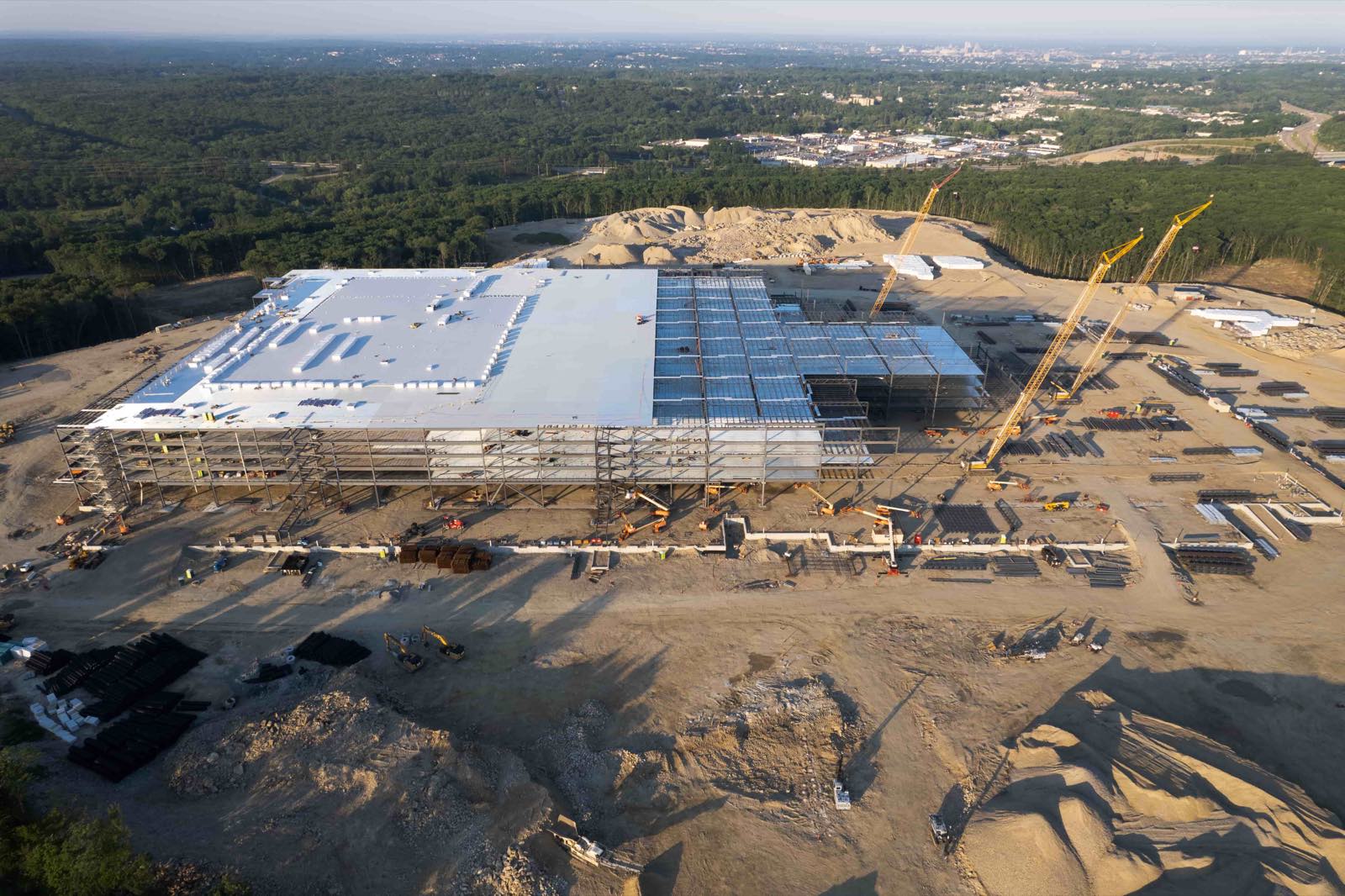
Drone maps shine on large sites where change happens across a broad area. Earthworks, road construction, mining, and landfill operations all benefit from a regular aerial survey. A single map can show how much material has been moved, where stockpiles have grown, and whether the work is staying within the planned boundary.
For projects that require volume calculations, drone maps are the clear choice. Cut and fill volumes can be computed from two maps taken at different dates. The numbers feed directly into payment calculations, production reports, and environmental compliance documents.
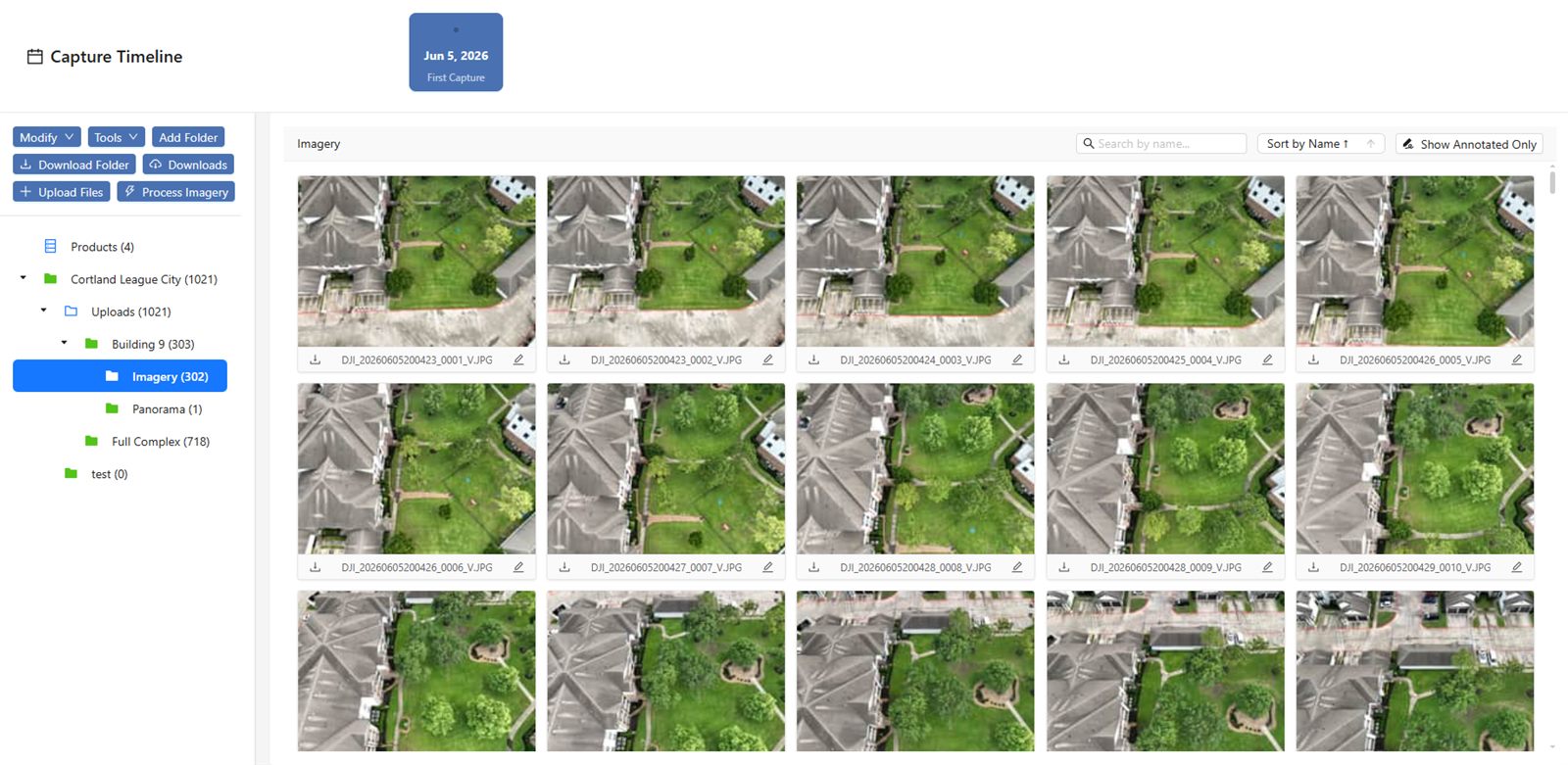
A drone data platform makes this process practical. Instead of downloading raw images and running them through desktop software, the platform handles the stitching, the georeferencing, and the storage. Project managers can log in from anywhere, view the latest map, and compare it to previous ones without needing special software on their own computer. The platform also keeps a chronological record, so anyone can scroll back through the history of the site.
Combining the Two for a Complete Report
The most useful progress reports do not choose one method over the other. They combine drone maps for context and measurement with ground photos for detail and verification. A weekly report might include a drone map showing the overall site, with callouts that link to ground photos of specific areas. That way, a stakeholder can see the big picture and zoom in on the details that matter.
Deciding which to use for a given project depends on the questions the report needs to answer. If the question is "How much material has been moved this week?" the drone map is essential. If the question is "Is the waterproofing membrane installed correctly?" a ground photo is the way to go.
Organisations like National Drone Services provide the infrastructure to make this combination work smoothly. Their platform handles the upload and processing of drone data, so project teams can focus on interpreting the results rather than managing files. The same platform can store ground photos alongside the maps, keeping all visual evidence in one place.
For project managers, the practical step is to set a standard for each reporting period. Decide what ground photos will be taken and where. Decide how often drone flights will occur and at what resolution. Document these standards so everyone on the team knows what to expect.
Practical Considerations
Weather affects both methods. Drones cannot fly in rain, high wind, or low cloud. Ground photos can be taken in most weather, but light quality matters. Overcast days produce even lighting and fewer shadows, which is good for both drone images and ground shots.
Time of day also matters. For drone maps, midday sun creates harsh shadows that can hide detail. Early morning or late afternoon with a high overcast gives the best results. For ground photos, side lighting shows texture better than flat overhead light.
File management is another factor. A single drone flight can produce hundreds of images, and the processed map can be several gigabytes. A drone data platform handles this by storing the data in the cloud and presenting it as a viewable map. Ground photos are smaller but accumulate quickly. A consistent naming convention and folder structure helps keep them organised.
Making the Choice
There is no universal answer. A small project with tight deadlines and simple scope may do fine with ground photos only. A large earthworks project with weekly volume reporting would be incomplete without drone maps. Many projects fall somewhere in between.
The best approach is to start with the questions the report must answer. If those questions involve location, quantity, or change over a broad area, drone maps are the tool. If they involve condition, finish, or access to confined spaces, ground photos are the tool. Using both together gives the most complete picture.
For teams that want to streamline their reporting, working with a provider that offers both capture and data management makes sense. The services of National Drone Services cover the entire workflow, from flying the site to delivering a usable map on a platform that everyone on the project can access. That removes the technical burden and lets the project team focus on the work itself.
National Drone Services on social media
 Facebook